Field Activities
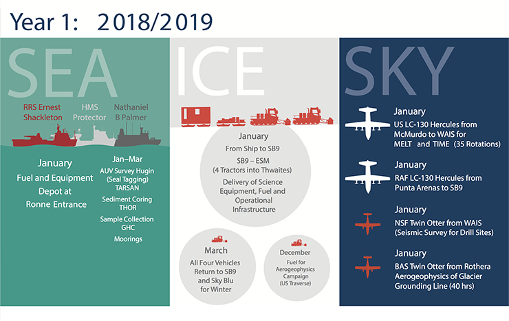 Plans for first year of field activities
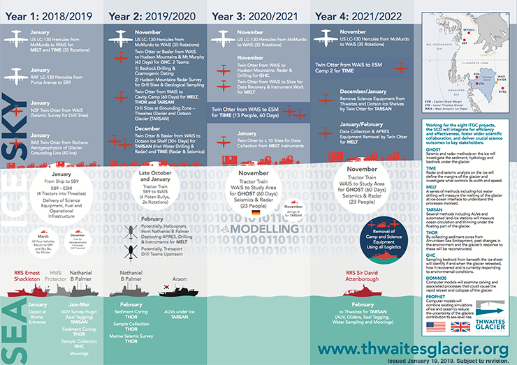 ITGC four-year plan overview as of January 19, 2019
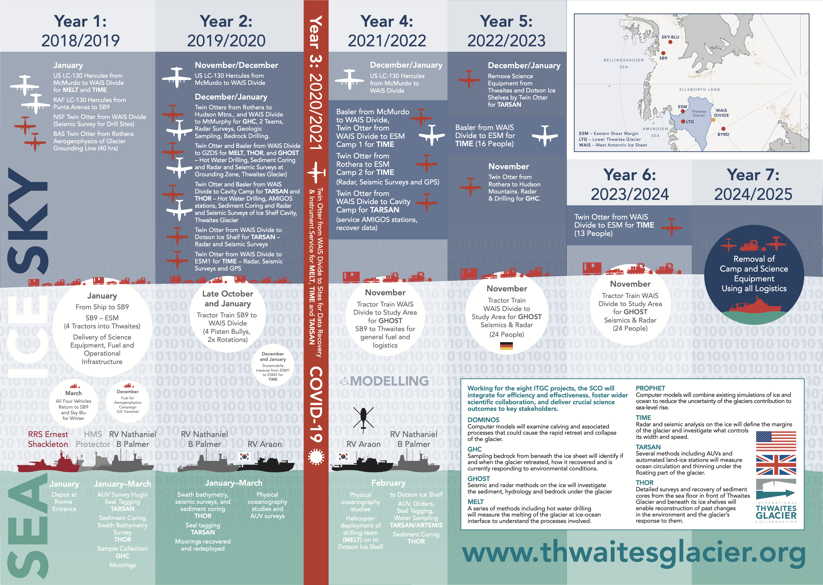 ITGC overview as of July 2022
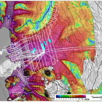
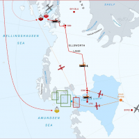
Thwaites Jan 2019 BAS aerogeophysical survey plan
Map of BAS airborne geophysical survey area and planned flight lines in white. Colors indicate ice flow speed, showing the broad area of rapid flow and the many tributaries of Thwaites reaching into the interior of the West Antarctic Ice Sheet. Black contours show surface elevation. The sky-blue oval areas are lakes of water beneath the glacier. Survey equipment: Radar: PASIN2 depth sounding radar, with 12 antenna array (including belly antenna). Configured in polametric mode, i.e. 4 antennas on one wing are orientated at 90 degrees to the rest of the array. CRESIS snow radar. Gravity: L&R stabilised platform. iMAR strapdown gravity sensor. LIDAR: Regal scanning lidar Magnetics: Two wing-tip Scintrex Cs sensors, and fluxgate with PicoEnvirotec data acquisition system.